![]()
BOOKMARK THIS PAGE!!!
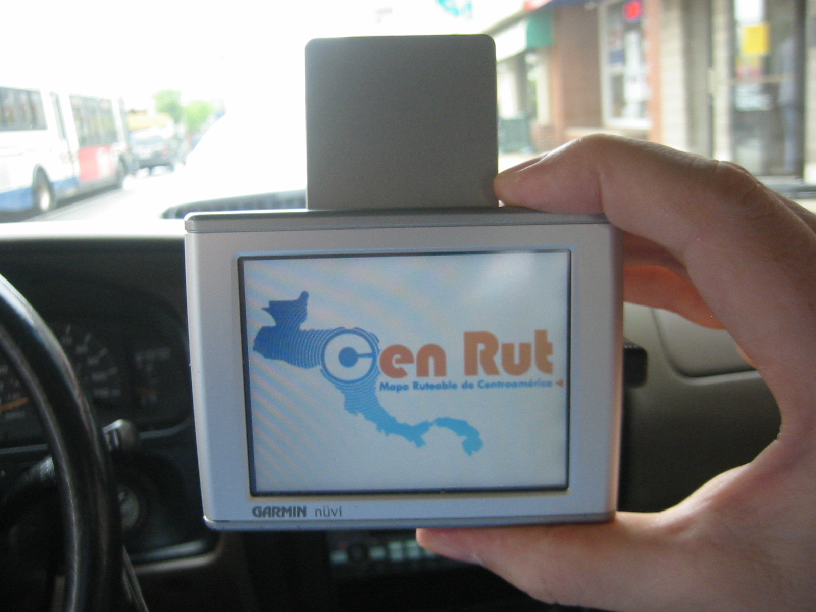
Overview of the CenRut project (Updated January 28, 2020)
CENRUT 3.9 IS CURRENT VERSION
See the pictures and read the blog posts from Mike & Hanna's bike trip in Central America(check out the awesome Guatemala volcano pictures!) Click here: https://www.highlux.co.nz/blog/What is CenRut?
CenRut is a community-based project to create and distribute GPS maps of
Central America(freely to humanitarian organizations). The project covers El Salvador, Costa Rica, Nicaragua,
Guatemala, Honduras, Belize and Panama.
How do I load the maps onto my Garmin GPS?
The simple Garmin method(not free, THANK YOU for your support!): Simplify your life and support the project! If you have a Garmin GPS click on this link (not free, contribution required):
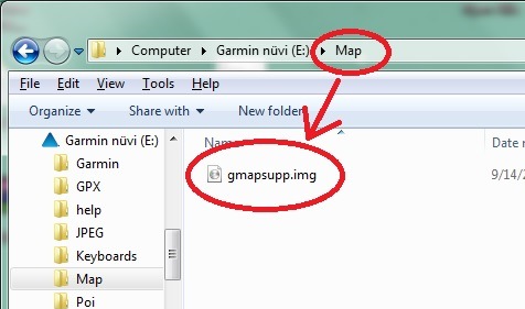
:to save the GMAPSUPP.IMG file onto your computer. Then connect your GPS to your computer and save the file in the /Map/ folder on your GPS. After saving the file to your GPS, disconnect the GPS from your computer. That's all!
***************************************************
Cenrut For Android Phone or Tablet: : (not free, contribution required):
***************************************************
The complete Garmin method: please refer to the complete Windows or the complete Mac method below, as appropriate, then download the installer below( (not free, contribution required):
Cenrut installer for Mapsource and / or BaseCamp 4.6 For Windows (not free, contribution required):
:Cenrut installer for Mapsource and / or BaseCamp For Macintosh (not free, contribution required):
:***************************************************
Note: addresses in Latin America are unreliable, so you need to search by the name of the Point of Interest that is your desired destination.
After loading CenRut onto your GPS(with either the simple or complete method), the file should be in this folder on your Nuvi:
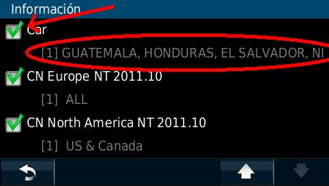
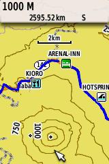
How do I know if the Cenrut maps are correctly loaded onto my GPS?
Start your GPS and go to Tools>Settings>Map>Info. You
should see the following:
OK, I have verified that Cenrut is loaded onto my GPS and appreciate all the hard work, now what?
Send me a courtesy email(optional) and tell me where you are going! My email address is at the bottom of this page.
Random note about car rental in Costa Rica:
Be warned that car rental
insurance is a bit of a racket(Adobe RentaCar might be an exception). Even if your rental company swears that the
quoted rate is all-inclusive, this is usually not the case. More info
here
Can I send data corrections for the maps?
Yes! Please send waypoints and tracks you have recorded, or just describe in an email the item that needs to be corrected!
How good are the maps?
In six of the seven coutries, they are better than the other options we have seen.
The seventh country is Costa Rica, which is lucky enough to have three great
options: TRACKIT (commercial), NAVSATCR(commercial) and CENRUT(free for
development organizations and contributors).
Why do you do this?
We believe that this is an immensely valuable project that allows us to apply
modern technology to help raise the standard of living in Central America. Plus,
we enjoy it.
Who are you?
The project leader is Willy, who lives in El Salvador. CenRut also works with
similar projects in other countries, including Venezuela (gpsyv.net), Argentina
(proyectomapear.com.ar), and Peru (perut.org).
How do you finance all this?
We used to be able to generate enough funds indirectly(Google ads, Amazon
referrals, donations) but those sources have decreased over 95%, so we are
asking for contributions. Plus the quality of the maps has reached a point
that they are well worth the price.
How else can I help?
Send me an email after you use it, and tell me if anything needs to be corrected! Also please send any favorites/waypoints that should be added! Email address is at the bottom of the page.
1) Garmin Basecamp 4.6(click bottom right indicating "100MB") since later versions disallow third party maps: https://garmin-basecamp.software.informer.com/4.6/
2) Garmin Mapsource: https://www8.garmin.com/support/download_details.jsp?id=209
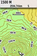
CenTopo(Topographic map of Central America):
To download the Topographic installer for Mapsource(released 2011), please
click here:
CenTopo installer
It is a 50m contour line map that is derived from NASA’s SRTM data. If you want it to work together with
Cenrut, be sure to load both onto
your GPS at the same time.
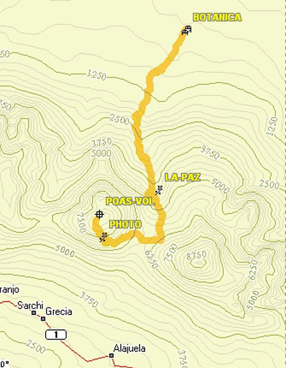
Images courtesy of Jack Yeazel:
 |
 |
 |
| Centopo+track in Mapsource | Centopo on Garmin 76cx | Cenrut+Centopo on Garmin 76cx |
The complete method por MAC users:
You need to install the Garmin MapManager and RoadTrip or BaseCamp for MAC.1) Install software Garmin RoadTrip or BaseCamp ( for older Macs you may need the Legacy version of Basecamp)
2) Install software Garmin MapManager
3) Install Cenrut for Mac(see above):
GPS on your mobile phone: Navikey/7Ways is a free App that works very well with the Cenrut maps. We also publish in Navitel format, but the App is not free.
Have you had any press coverage?
A little, but please help us get more press coverage of the project!: Article in Honduras paper October 2014 article in AAPG Explorer
Feel free to drop me an email: David Krause Washington, DC dakrause(at)hotmail.com